
According to new data issued by the Bloomberg administration Monday, many more people will be living in high flood-risk areas of New York City in the coming decades. Currently, 398,000 people live in NYC’s 100-year flood plain–the area of the city with a one percent chance of flooding in a given year. Bloomberg’s team expects that number to more than double, to 800,000, by the 2050s. The numbers have at least as much to do with climate change and rising sea levels as they do with general population increase–the New York City Panel on Climate Change believes water will rise by four to eight inches (possibly as many as 11) by the 2020s.
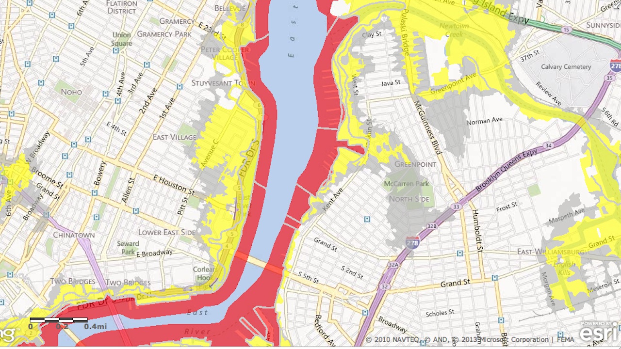
FEMA also had flooding on the brain yesterday. The federal agency updated its flood maps for the city, which determine flood insurance rates based on location, after maps released in the wake of Hurricane Sandy were criticizing for bringing up insurance premiums. WNYC points out one major change with the new maps: parts of Broad Channel, Queens, and Oakwood Beach, Staten Island, which had been designated high-risk “V-zones” after Sandy, have lost that status on the new maps. The new maps will need approval before they’re officially adopted, but in the meantime, you can check them out here.
