
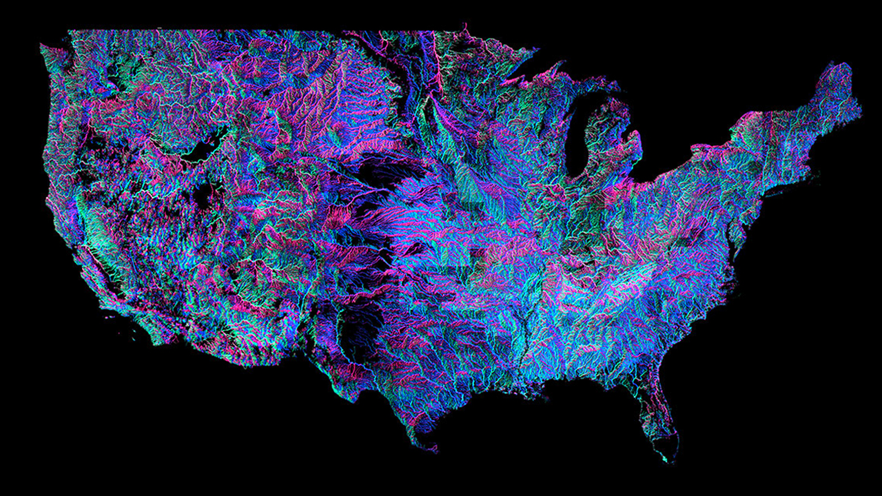
Andrew Hill of data-visualisation firm Vizzuality has put together this insane interactive map for you to peruse the United States complex system of rivers and he’s color-coded it out in that distinct black light poster style.
The colors are based on the direction each river flows. New Scientist explains:
“There are 18 distinct colours around the compass,” says Hill. True pink, for example, represents a river that runs north-south or south-north. When zoomed far out, as in the main image, the colours tend to blend in. But as you zoom in, pinks, blues, greens and reds jump out at you, as seen in the inset photo below, of the region just north of Los Angeles.
You can scroll around the elaborate network of rivers below and just keep zooming to see the individual rivers.
(Photo: Andrew Hill)
