
That stream of drunken tweets you and your friends send at night may be good for something aside from eye-rolls and inside jokes. According to siblings Enrique and Vanessa Frías-Martínez, two Spanish computer science researchers, geolocalized tweets could be used to urban planning and land use. In a study published in Engineering Applications of Artificial Intelligence, they argued that activity on Twitter could show how people interact with the city — specifically at night. “A forgotten issue in urbanism is land use during the night time,” notes Science Daily, “with problems such as noise and dirt, which could be improved with this type of tool.”
Said Enrique Frías-Martínez:
You can capture information on urban land use more efficiently and for a much larger number of people than with questionnaires. Moreover, this type of consultation, traditionally used until now in planning activities, are very costly and can cause problems due to the lack of accuracy of the answers.
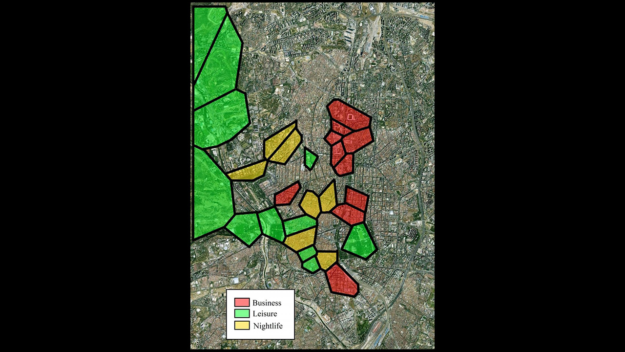
The new technique “automatically determines land uses in urban areas by grouping together geographical regions with similar patterns of Twitter activity,” says the researcher.
The researchers aggregated tweets in Manhattan, Madrid, and London, and identified distinct “residential, business, daytime leisure (mainly parks and tourist areas) and nightlife areas. In London, they also established industrial land uses. These results were validated with open data sources.”
(Image: V. y E. Frías-Martínez)
