
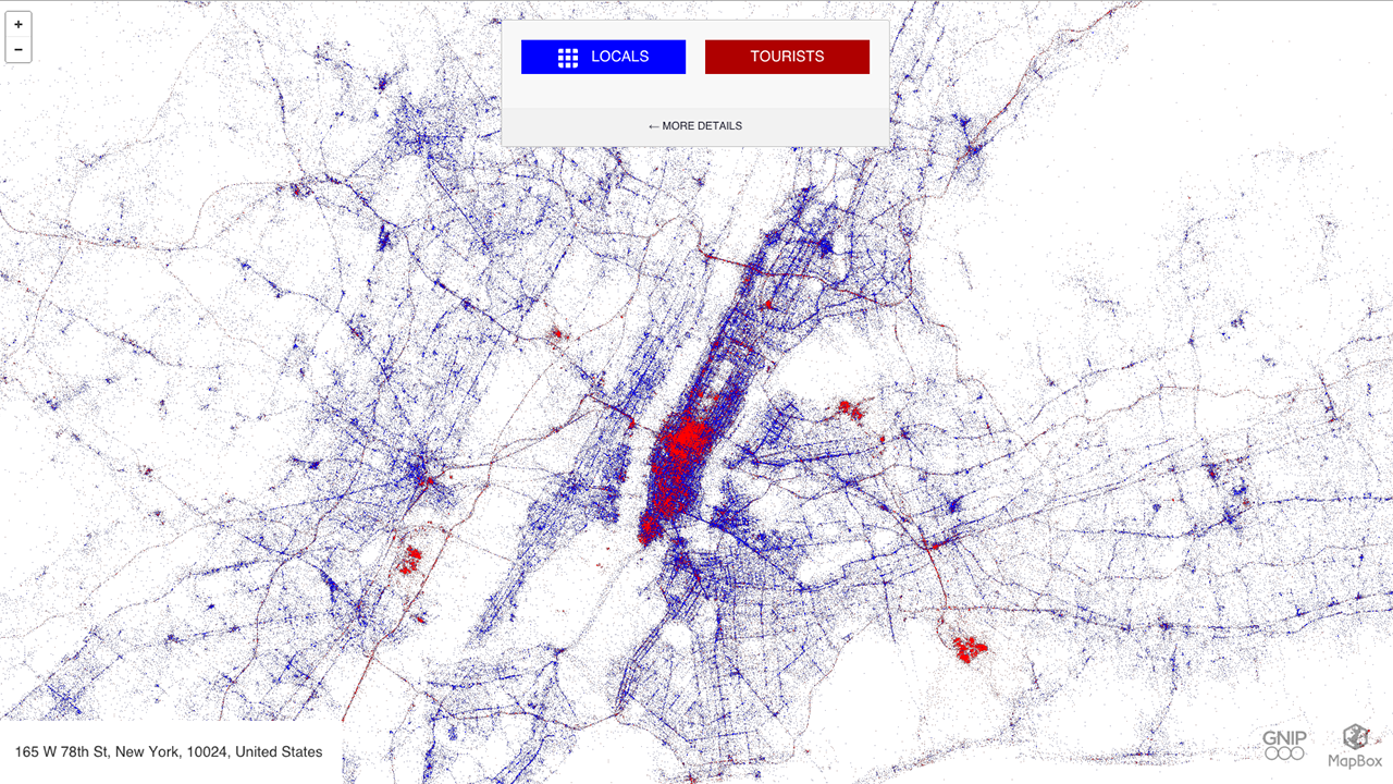
Eric Fisher, a man who turns human movement into art through his unique maps, has created an interactive world map that shows how tourists and locals occupy major cities via their tweets.
For “Tourists & Locals,” Fisher mapped geo-tagged tweets between September 2011 and May 2013 and ascribed a blue color to locals and the color red to tourists. Though it’s not exactly how longtime New Yorker residents would define themselves, Fisher called locals people who’ve been tweeting from a specific area for 30 days or longer. What’s particularly neat about these maps, CityLab reports, is that they “are not overlaid onto an existing world map; rather, they manifest into recognizable urban geographies.”
The project is a twist on his 2010 mapping project, in which he geo-tagged Flickr photos of 130 cities. You can see his photo for New York below:
 Photo: Eric Fisher/Flickr
(Photo: Eric Fisher)
