
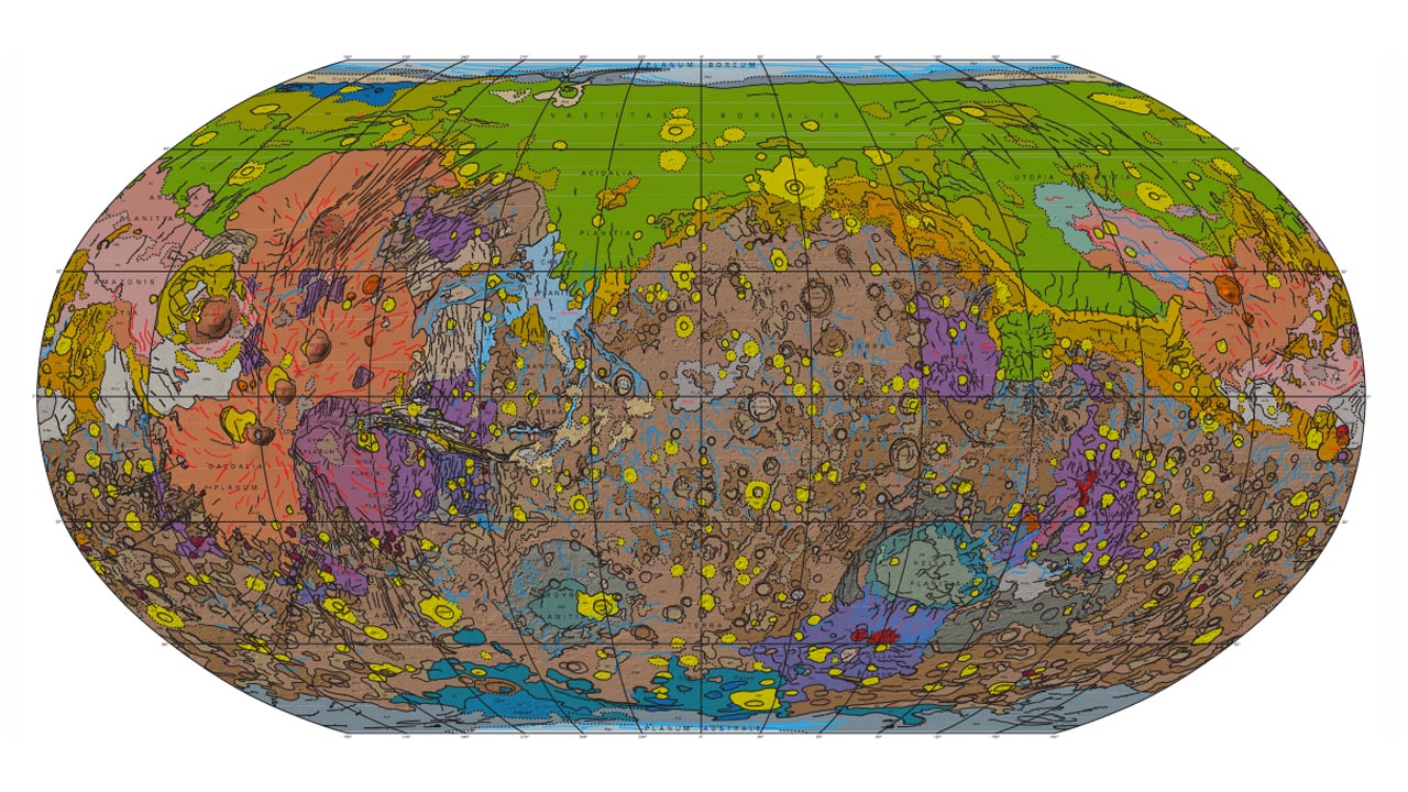
A new map of Mars produced by the US Geological Survey (USGS) is the most detailed yet, revealing new nuances about the planet previously unknown to science. The data was captured by three different spacecrafts — the Mars Global Surveyor, Mars Odyssey and the Mars Reconnaissance Orbiter.

The colors of the crust represent various processes that created that area in different time periods.
“The extensive green area near the north pole represents lowland plains formed during the Red Planet’s Hesperian Epoch, about 3.7 billion to 3 billion years ago,” Popular Science explains. Over 600 million altitude measurements were used to bring us this impressive guide to the Red Planet. See the full map as a PDF here. (Image: USGS)

