
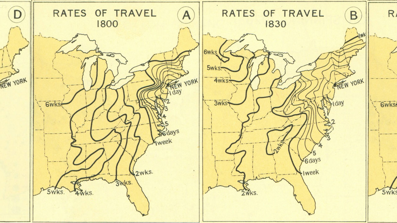
Ever wonder just how much more inconvenient transit was back in the days before airplanes and the interstate highway system? A set of maps unearthed by Mother Nature Network goes into detail. The maps, produced by the Atlas of the Historical Geography of the United States in 1932, use New York City as a starting point to show the time it took to travel to various locations across the country in 1800, 1830, 1857, and 1930.
In addition to serving as a reality check for how easy we have it now, transportation-wise, the charts also illustrate how quickly vast advances were made in the late 19th and early 20th centuries. Between 1800 and 1830, for example, the time from New York to Chicago was cut in half, from six weeks to three, all thanks to advances in steam train technology.
By 1930, still well before the heyday of commercial aviation, that travel time had been reduced to just one day.

")
(Images: Mother Nature Network)

