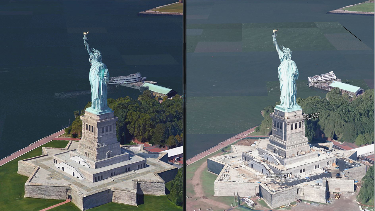
As impressive as they are invasive, Google Maps are about to get a lot more detailed. The company has introduced 3D imaging to Google Maps and Google Earth in San Francisco and New York, with more cities getting rendered in 2015. TechCrunch reports that the change comes from “better cameras and improved algorithms,” which really help flesh out the shapes (notice the boat). Take a look at the differences in the image above.
At some point during his Google Maps-scouring endeavors, German artist Daniel Schwarz noticed a strange phenomenon: the apparent coexistence of two contrasting seasons in the same place. Juxtapose is a collection of these glitched-out images, mostly of remote locations, taken directly from Google Maps. Although the satellite images give users a…
Today, Google released the latest in a slew of nifty maps-related toys: a set of HTML5-powered timelapses that show how our planet's landscape has changed since 1984. Google's people apparently sifted through 2 million satellite images to find the clearest photos possible, then assembled them chronologically into these looping animations. Watch Las…
Google Earth has glitches. These glitches make great art. Trapcode founder Peder Norrby's series of well-executed screen captures of glitched out iOs map images give us a vision of a post-nuclear-holocaust world. From trees melting into the streets and flattened cars on collapsed highways to a deadlier Coney Island Cyclone, these images -- produced, as always,…