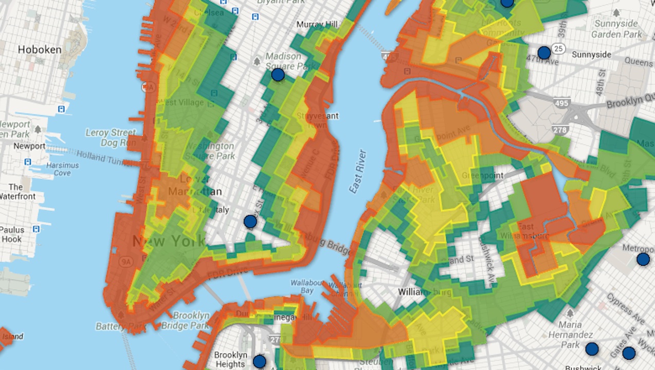
When Hurricane Sandy hit the city last year and officials were deciding who to evacuate, they didn’t have very many options, with only three flood zones: A (high risk), B (mid risk) and C (low risk). Now, in an effort to allow more nuanced plans and avoid over- or under-evacuation, the city has released a completely overhauled flood map, with six numbered zones (one is extremely high risk and six is low). In drawing up the new map, the city brought 600,000 new people into the zones, a fact it says has as much to do with growing population as it does with increased flood risk. Take a look at an interactive map of the new zones from WNYC below.