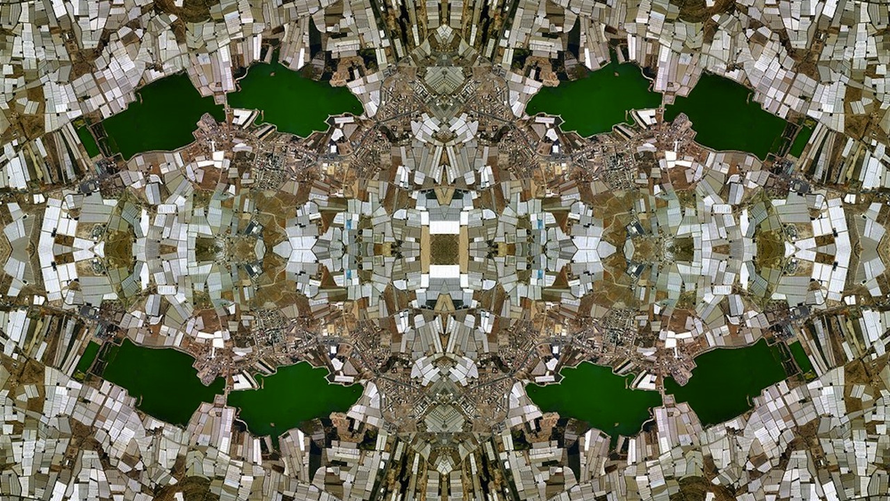
David Thomas Smith created these striking digital colleges by taking thousands of images from Google Maps, then stitching them together in Photoshop. And besides making the aerial view of your backyard look just like that totally trippy poster you had in college, the pieces have a more critical intent.
By refracting the landscapes into repeating, kaleidoscopic patterns, Smith hopes to evoke the vast, oft-unseen web of industry that drives capitalism worldwide. There’s probably something being said about global surveillance and our relative complacency regarding it as well–all of these seemingly sinister images are publicly available to anyone with a decent internet, after all. Either that or I’ve just been staring into the digital abyss for just a little too long.
At some point during his Google Maps-scouring endeavors, German artist Daniel Schwarz noticed a strange phenomenon: the apparent coexistence of two contrasting seasons in the same place. Juxtapose is a collection of these glitched-out images, mostly of remote locations, taken directly from Google Maps. Although the satellite images give users a…
From kaleidoscopic Rorschach tests to fractal persian rugs, Google Maps has its nifty artsy uses. This might be the greatest one yet: Google Street View Hyperlapse, aka your favorite new time-sucker. Created by Canadian digital studio Teehan + Lax, the program stitches together thousands of images from Google Street View to create…
Google Earth has glitches. These glitches make great art. Trapcode founder Peder Norrby's series of well-executed screen captures of glitched out iOs map images give us a vision of a post-nuclear-holocaust world. From trees melting into the streets and flattened cars on collapsed highways to a deadlier Coney Island Cyclone, these images -- produced, as always,…