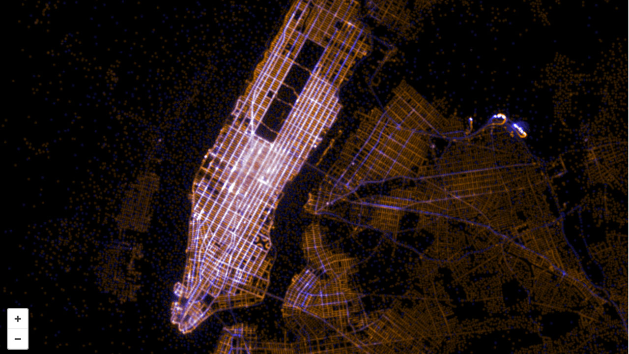
Twitter Traffic Map of New York

Art map master Eric Fischer is back to make cartographic sense of all that location data you’re giving away for free on Twitter. This is New York, with New Yorkers’ trips routed and their geotag density mapped out in “10000 points, 30000 vectors.” What do we learn? Broadway is “the spine.” Well, that does make sense. Read more »

The Flickr Vs. Twitter World Atlas: NYC and Beyond

Map geek extraordinaire Eric Fischer is back, mapping out who Tweets (in blue), who Flickrs (in red), who does both (in white) and where — from New York City to Tokyo to Amsterdam to Moscow and on — for his new project See Something or Say Something. See it city by city below. Read more »

Locals vs. Tourists: World Atlas of Photography

New York geo SF

In an amazing feat of cartography, Eric Fischer turned Flickr’s collective geotagging data into a world atlas of photo hot spots, by city. Better yet, they’re color-coded — blue for locals (taking photos in each city for a month or more) and red for tourists (taking photos in the city for less than a month/locals of a different city). Above: NYC and SF. Read more »