
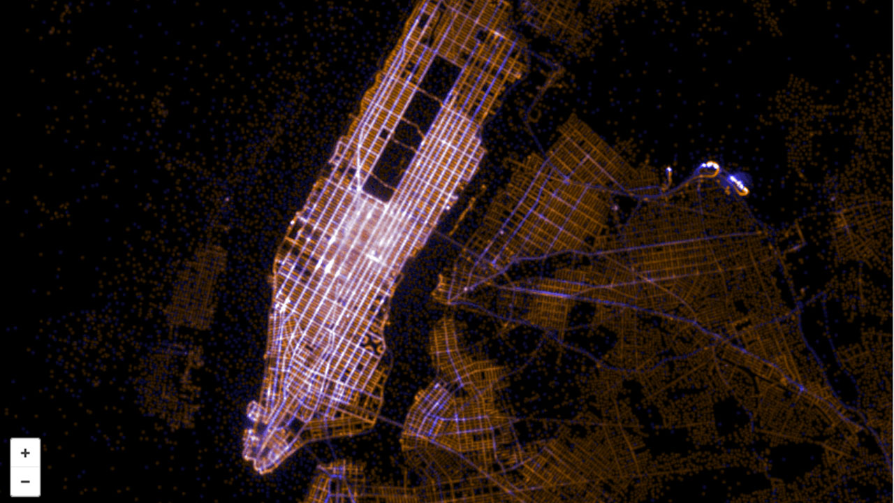
Since the installation of GPS trackers which record the beginning and end locations of each trip, taxi rides have been automatically creating a massive amount of data. Artists Chris Whong and Andrés Monroy used New York’s Freedom of Information Law to get access to this data, and Eric Fischer — one of our favorite data cartographers — created this map visualization. Here are all the taxi rides recorded in 2013, with blue indicating the ride’s starting location and red signifying the final destination.
The visual result is stunning, albeit pretty predictable, with New York’s major streets glowing with activity, much like a time lapse photo of traffic at night. Manhattan is very much ablaze with taxi activity, while the further you get away from it along the other boroughs, the less likely you are to get a ride, unless you are at the airport. Zoom in and out to see if you can learn more.
