Tag: locals
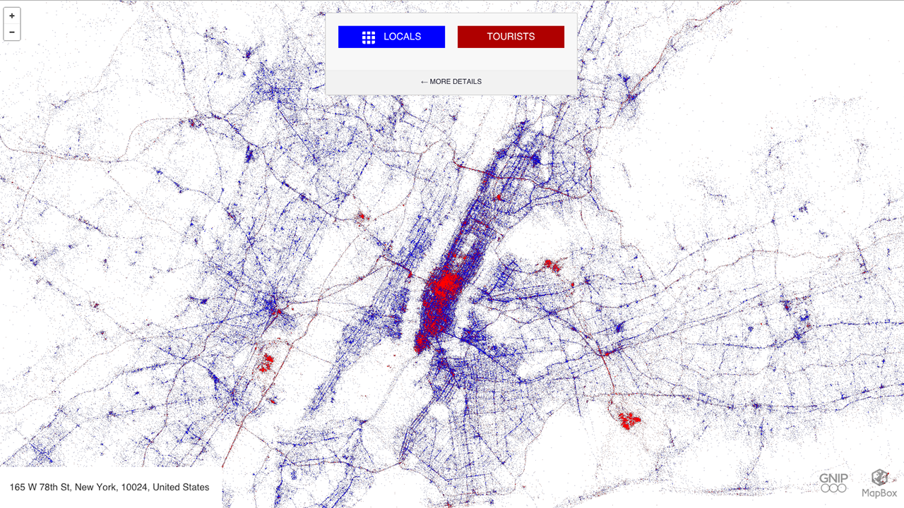
Eric Fisher, a man who turns human movement into art through his unique maps, has created an interactive world map that shows how tourists and locals occupy major cities via their tweets. For “Tourists & Locals,” Fisher mapped geo-tagged tweets between September 2011 and May 2013 and ascribed a blue color to locals and the […]


