Tag: Maps
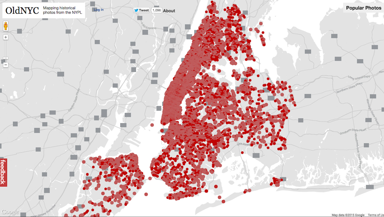
New York is pretty ancient and constantly in flux, which means lots of buildings that once existed are long gone or amazingly, still there, but surrounded by ugly new stuff, like badly-designed condo complexes or skyscrapers for the rich. Thanks to a partnership between software engineer Dan Vanderkam and the New York Public Library, anyone […]
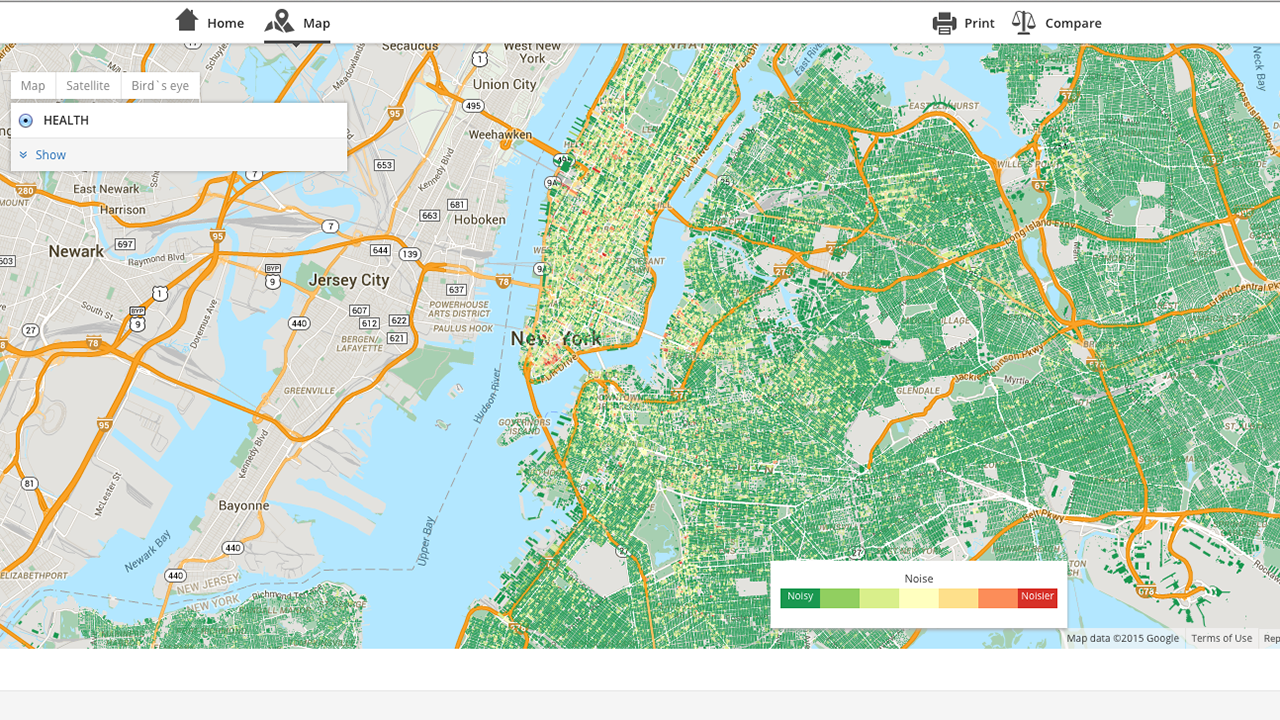
PlaceLive, a quality-of-life data reporting platform, compiles information about things like affordability and safety and presents the data in helpful map form. It shared some of its detailed maps of noise complaints throughout New York City with UpOut, and the results are kind of surprising. It gets pretty granular, looking lot-by-lot. The most noise complaints […]
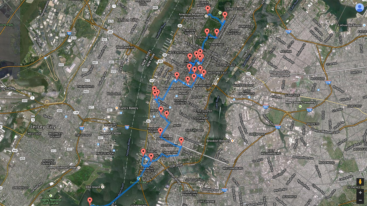
The next time your cousin-twice-removed and his bratty kid come in town and expect you to take them to all of New York City’s top tourist destinations, just have them consult this handy map. Created by computer scientist Randal Olson, it’s optimized for the shortest distance between routes, packing 27 of the city’s most popular […]
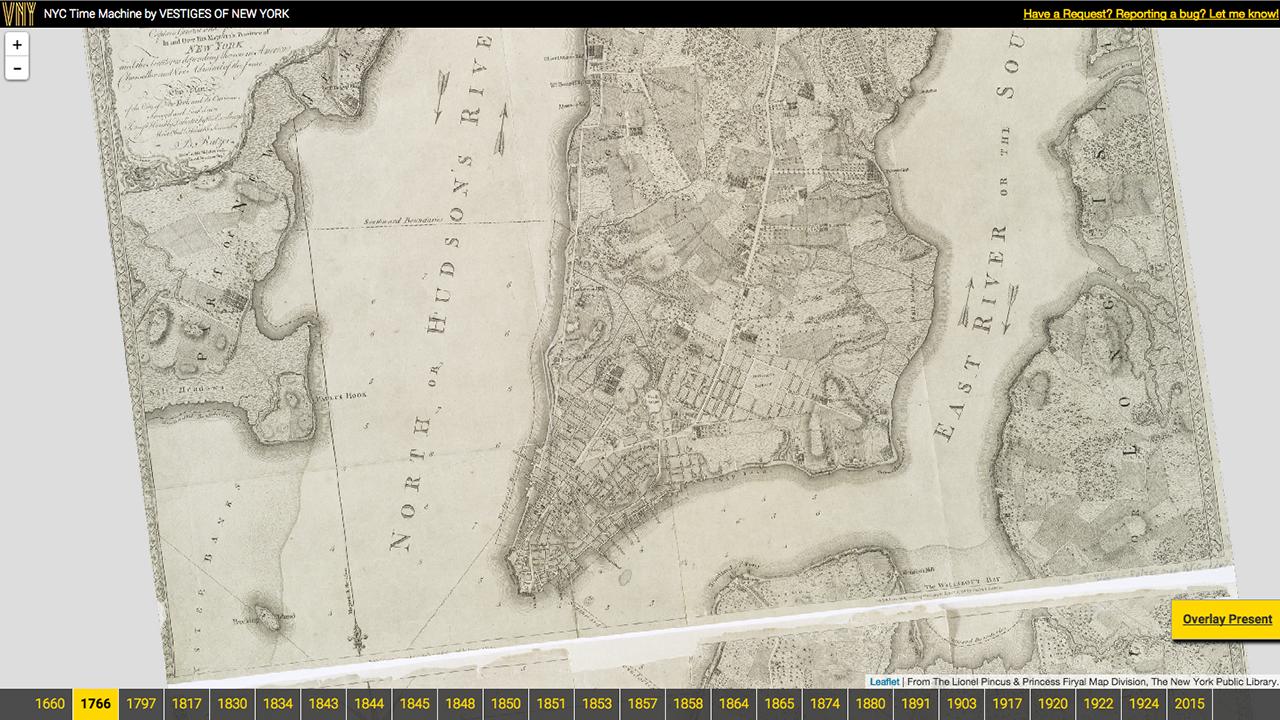
Twenty years is enough time for a New York neighborhood to change beyond the point of recognition, so it’s hard to fathom just how much change the city has experienced since it was founded in 1624, but a new tool by Vestiges of New York attempts to do just that. Orian Breaux is the creator […]
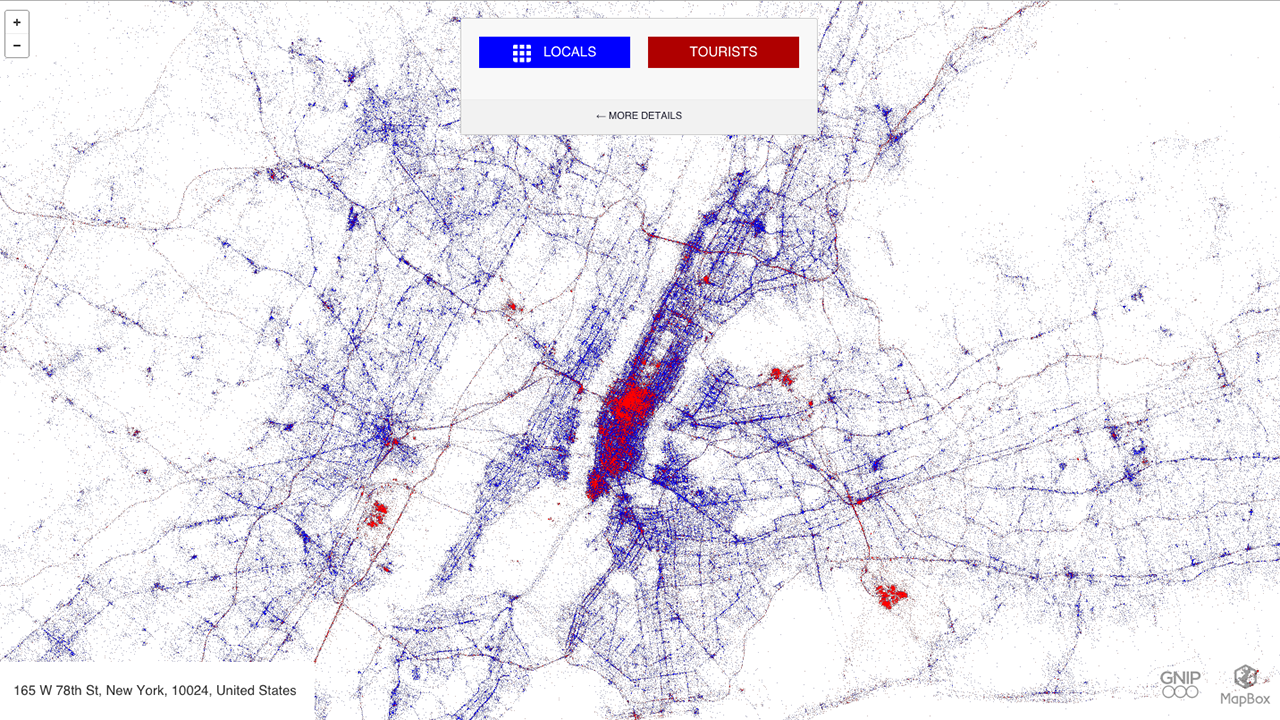
Eric Fisher, a man who turns human movement into art through his unique maps, has created an interactive world map that shows how tourists and locals occupy major cities via their tweets. For “Tourists & Locals,” Fisher mapped geo-tagged tweets between September 2011 and May 2013 and ascribed a blue color to locals and the […]
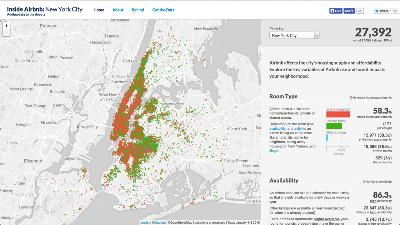
When facing accusations of potentially illegal activity from New York City officials in January, Airbnb defended itself by arguing that a majority of users rent apartments on occasion. The roomsharing service didn’t present any data at the time, but now community activist Murray Cox has scraped data from Airbnb’s site and put together an interactive […]
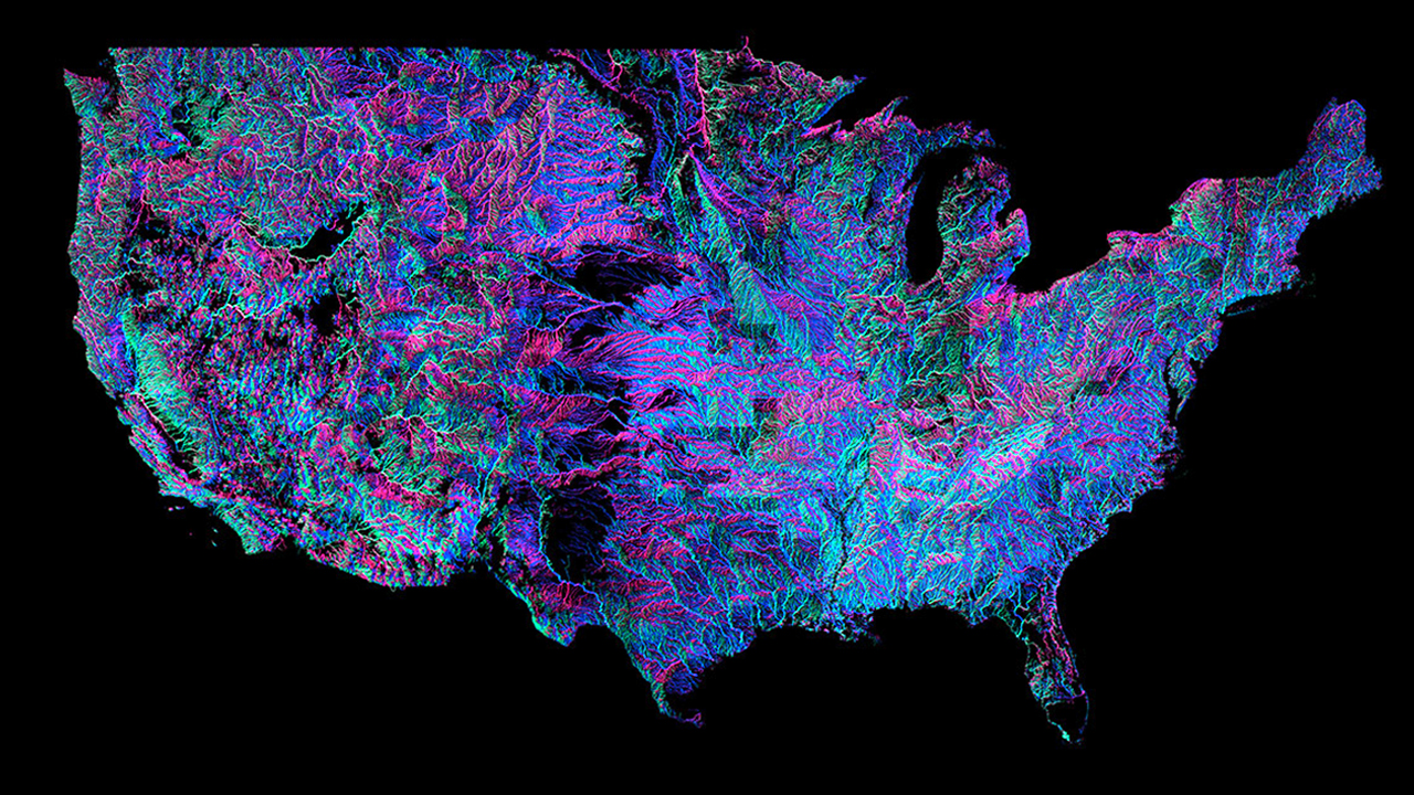
Andrew Hill of data-visualisation firm Vizzuality has put together this insane interactive map for you to peruse the United States complex system of rivers and he’s color-coded it out in that distinct black light poster style. The colors are based on the direction each river flows. New Scientist explains: “There are 18 distinct colours around the compass,” […]
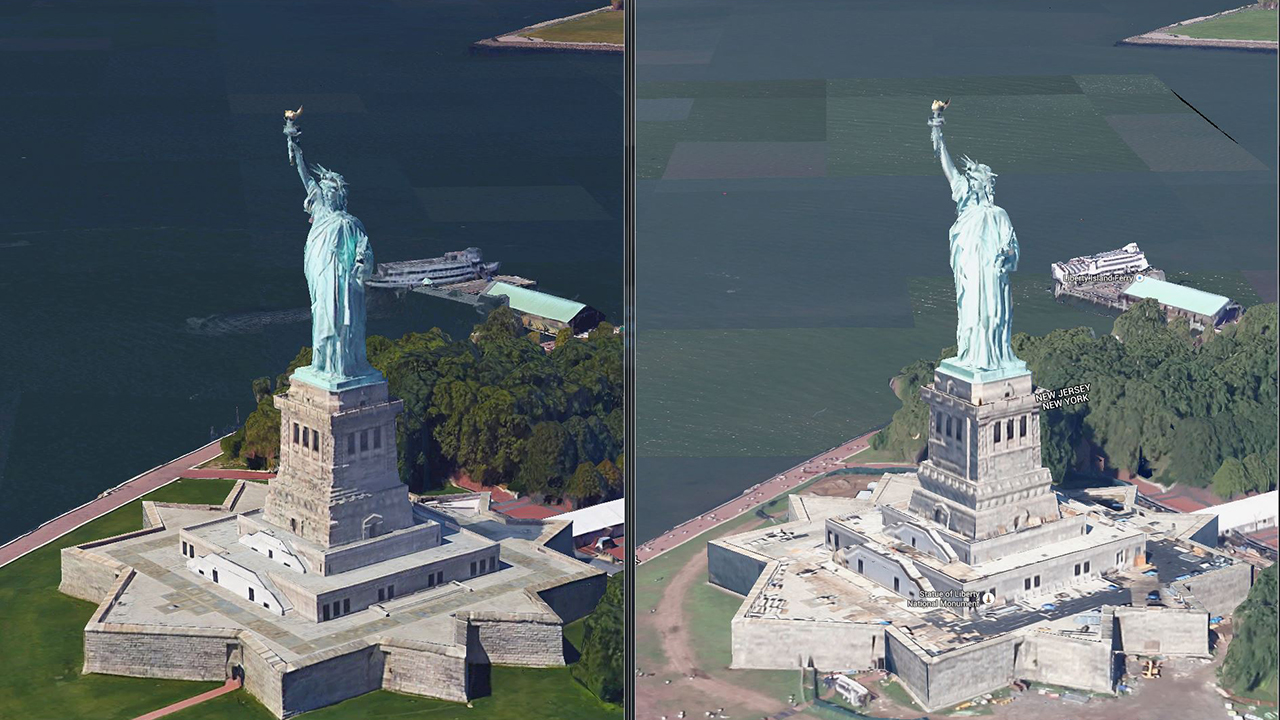
As impressive as they are invasive, Google Maps are about to get a lot more detailed. The company has introduced 3D imaging to Google Maps and Google Earth in San Francisco and New York, with more cities getting rendered in 2015. TechCrunch reports that the change comes from “better cameras and improved algorithms,” which really […]
City officials recently announced that the conversion of NYC pay phones into Wi-Fi hotspots will start at the beginning of next year. But before you get excited by the promise of free public wi-fi, there’s a catch: The Verge reports that poorer neighborhoods will be getting the short end of the stick, at least at […]
After a man was diagnosed with Ebola yesterday, everyone wants to know where Dr. Craig Spencer has been and what he’s been doing. Did he sneeze on the subway? Cough on his Uber driver? Spit on the High Line? A number of news sites have made maps for readers to track where Spencer went. For those […]

