Tag: Maps
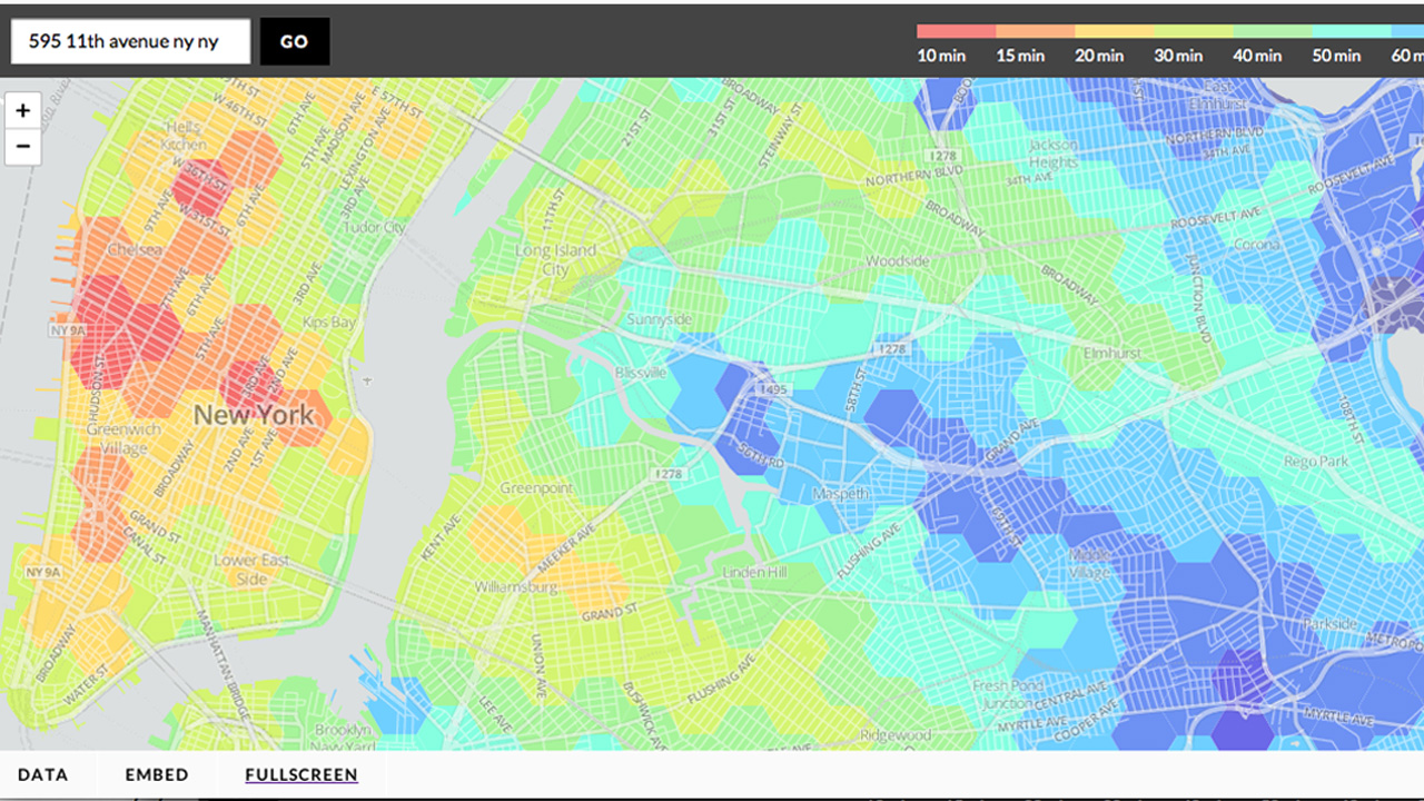
Do you tend to plan your daily outings based exclusively on travel time via public transit from Point A to Point B? Do you feel stifled when required to provide a specific destination by websites like Hop Stop and Google Maps? Do you just love being able to rearrange pretty colors with a random click of […]
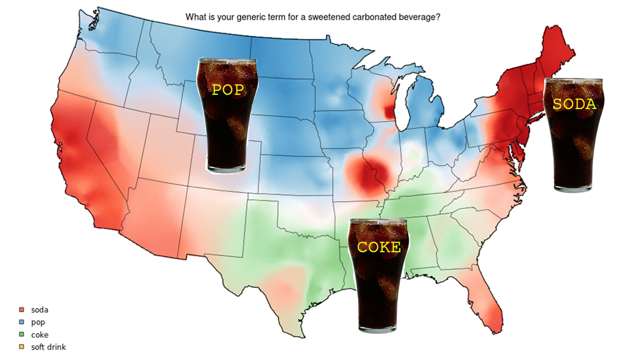
Just in time for Amurrica day, here are some nice little visual odes to our nation’s dialectical disunity. To visualize the vast regional differences in ways we refer to things like carbonated beverages and shoes designed for sports, Joshua Katz from NC State University made this amusing series of colorful infograpic maps. Conclusion: down south, people are […]

Near the ANIMAL office alone, there are purpleleaf plums, honeylocust, and swamp white oak. Near my apartment, black locust, small-leaved linden, and chokecherry. All of them are edible in some way–honey locusts’ pods can be eaten, as can black locust’s flowers, and the seeds of swamp white oak can be used as a thickening agent. […]
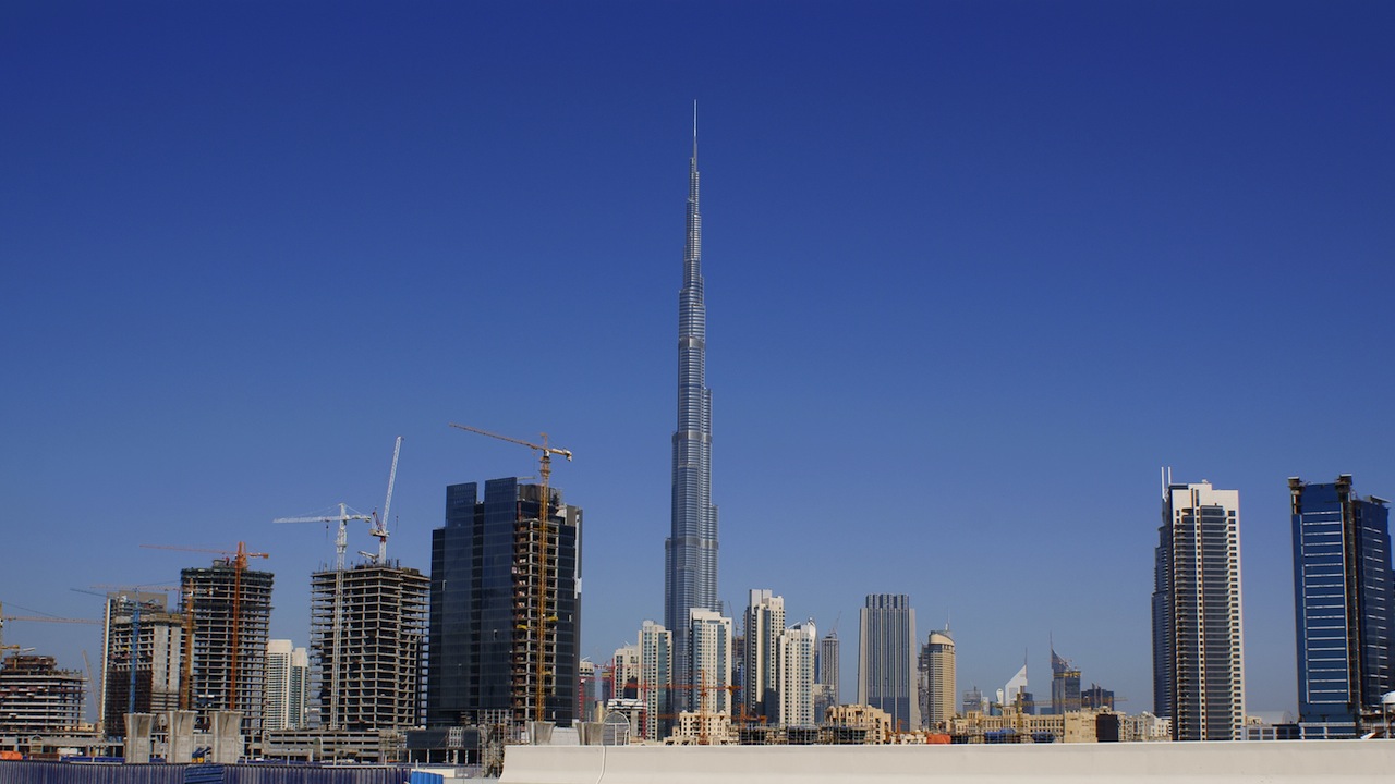
At 2,722 feet, Dubai’s Burj Khalifa, the world’s tallest building, is almost 1.5 times the size of the finished 1WTC, at 1,776 feet (take that, freedom!). What’s it like inside? The latest installment of Google’s Trekker Street View project, which maps areas inaccessible to the company’s camera-equipped vans (check out the Grand Canyon here) goes […]
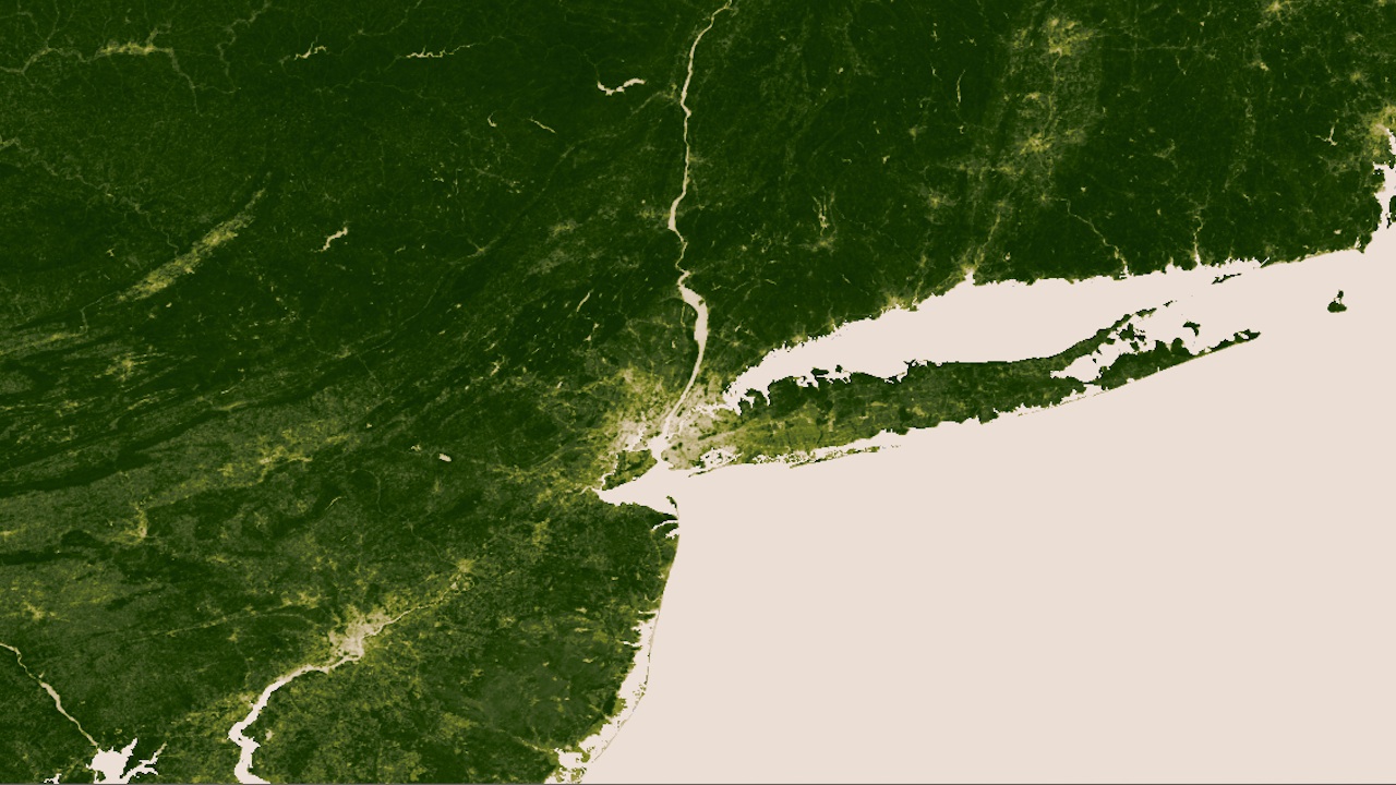
If you’re already over that billion pixel image of Mars we showed you yesterday, here’s your latest high-res space photo fix: NASA and NOAA created this image of the Earth using something called a “VIIRS sensor,” which works kind of like an infrared camera for trees, highlighting any vegetation in lush green and rendering everything else […]
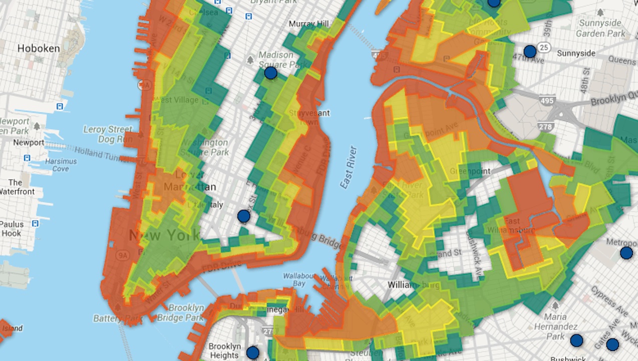
When Hurricane Sandy hit the city last year and officials were deciding who to evacuate, they didn’t have very many options, with only three flood zones: A (high risk), B (mid risk) and C (low risk). Now, in an effort to allow more nuanced plans and avoid over- or under-evacuation, the city has released a […]
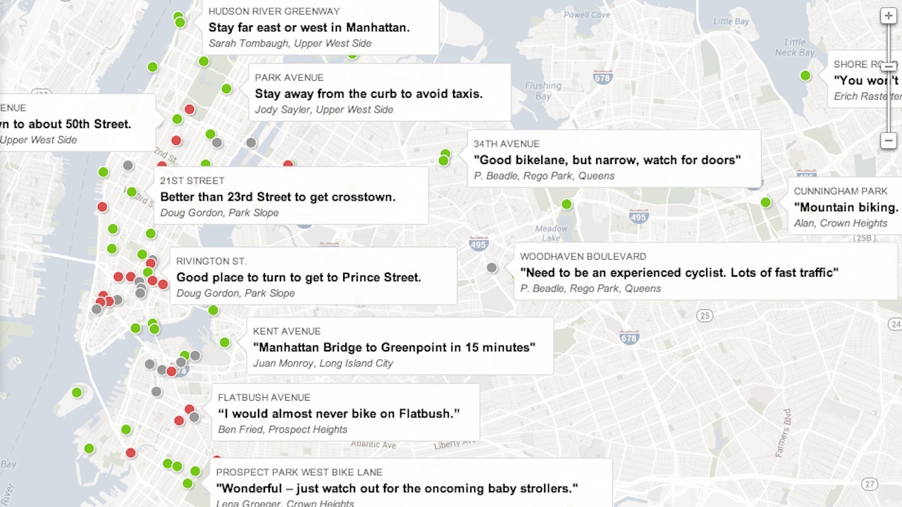
Absorb the cycling know-how of an entire city with this crowdsourced map from the New York Times, which allows anyone to add ten words of wisdom to any location in the five boroughs. A few choice cuts –Maris from Park Slope says Clinton St. is a better route to the Brooklyn and Manhattan Bridges than Smith, Erich […]
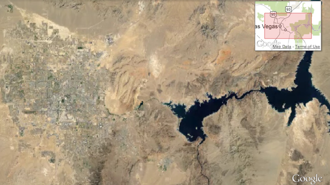
Today, Google released the latest in a slew of nifty maps-related toys: a set of HTML5-powered timelapses that show how our planet’s landscape has changed since 1984. Google’s people apparently sifted through 2 million satellite images to find the clearest photos possible, then assembled them chronologically into these looping animations. Watch Las Vegas spreading like a virus […]
Yesterday marked a major milestone for experimental psych advocates, aging hippies and rave kids alike: a meeting was held at the Pentagon to discuss legitimizing MDMA for use in psychotherapy. Rick Doblin, founder of the non-profit Multidisciplinary Association for Psychedelic Studies (MAPS), was invited to make a case for MDMA-assisted psychotherapy in treating PTSD victims. […]
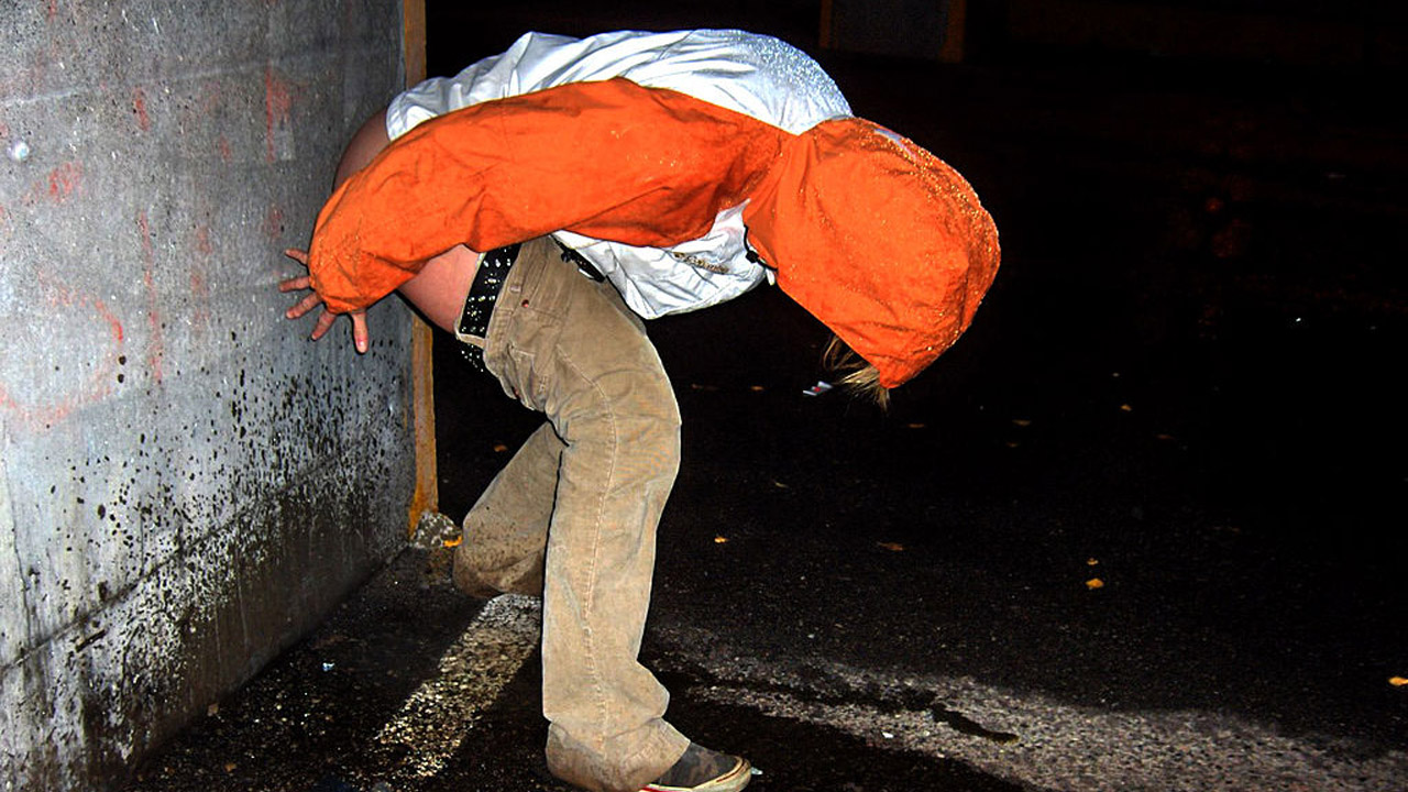
Nothing tops off a wild night on the town like a nice, long, public pee. But as many intrepid squat-poppers have learned the hard way, public urination can also be a total buzz kill if a police officer catches you mid-release. Worry no more: Courtesy of Gothamist, here is an interactive map that shows where […]